SMapper
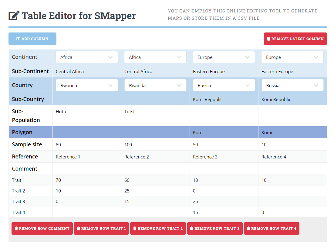
Visualization tool
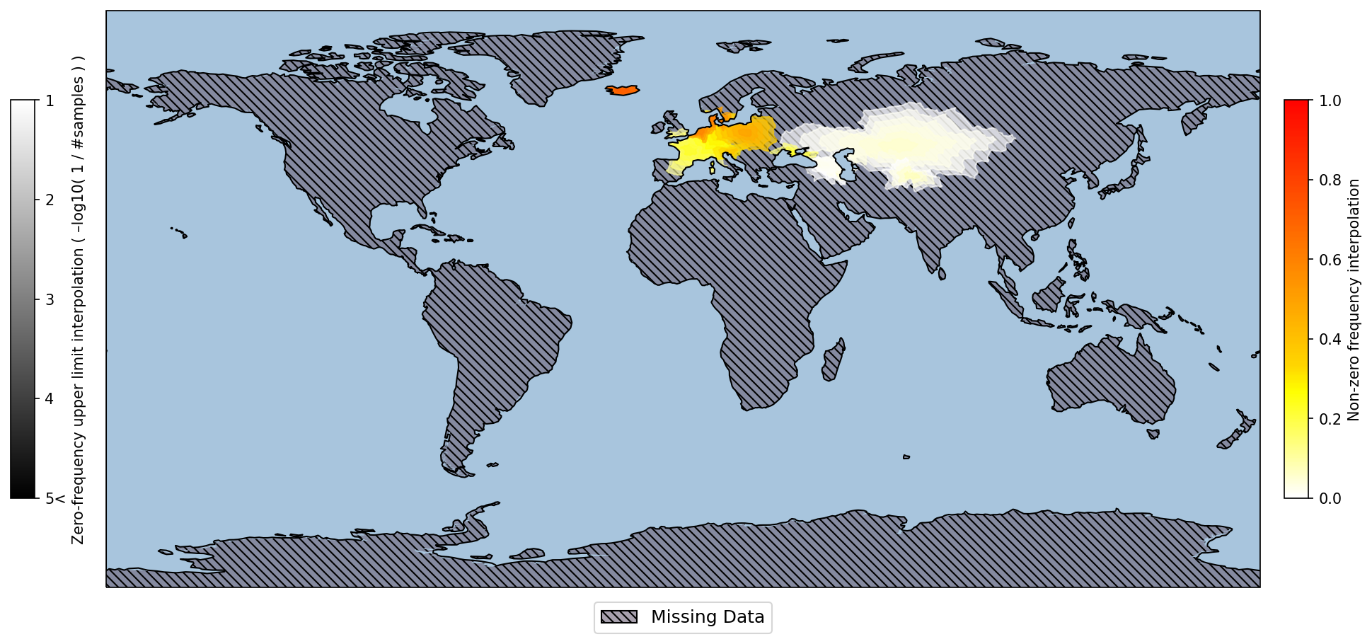
SMapper aims at adequately visualizing any type of spatial prevalence data, in particular sparse data of limited geographic coverage generated from small sample sizes.